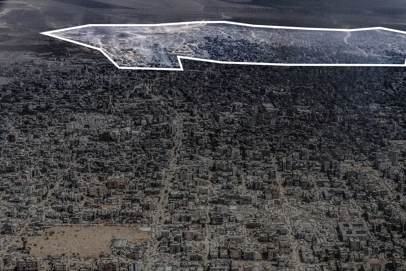
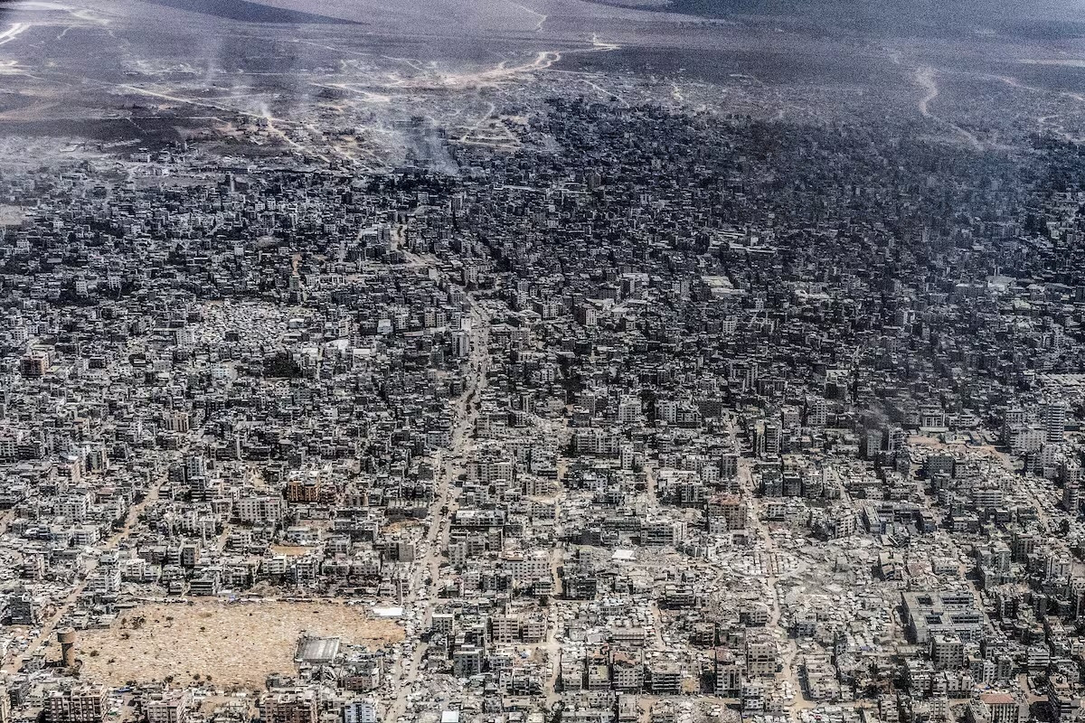
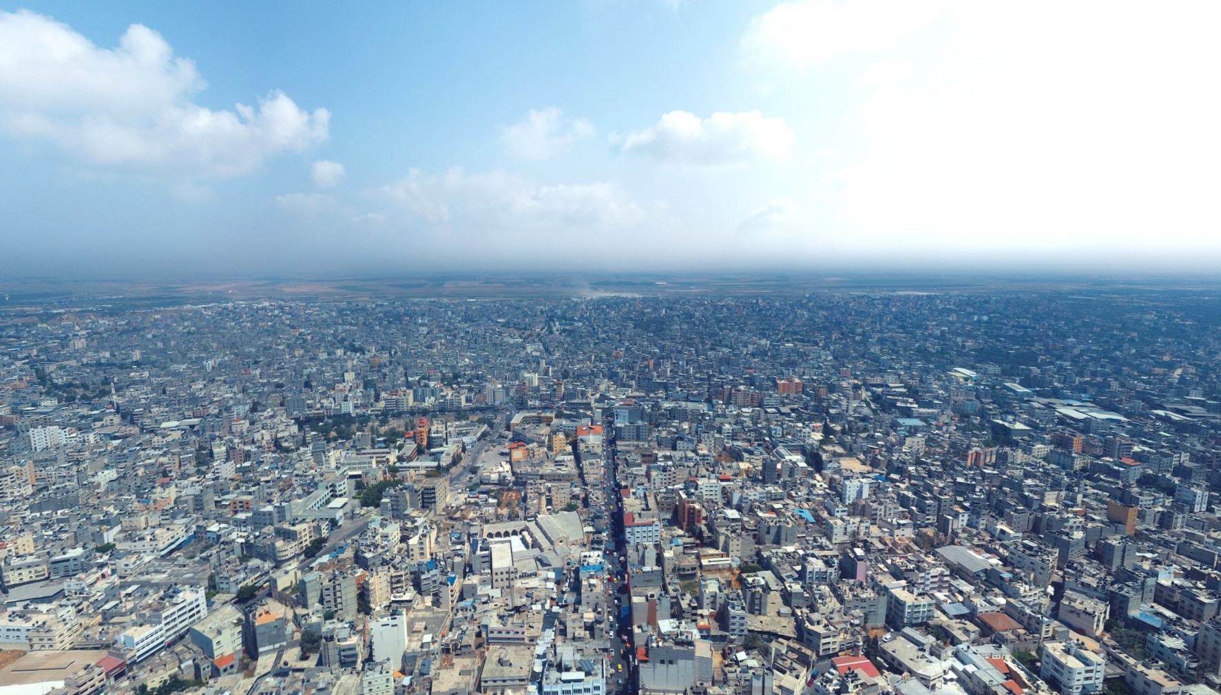
An aerial view of what the Gaza City area looked like this week. Taken from a Jordanian military aircraft, by our colleague Heidi Levine.

An aerial view of what the Gaza City area looked like this week. Taken from a Jordanian military aircraft, by our colleague Heidi Levine.
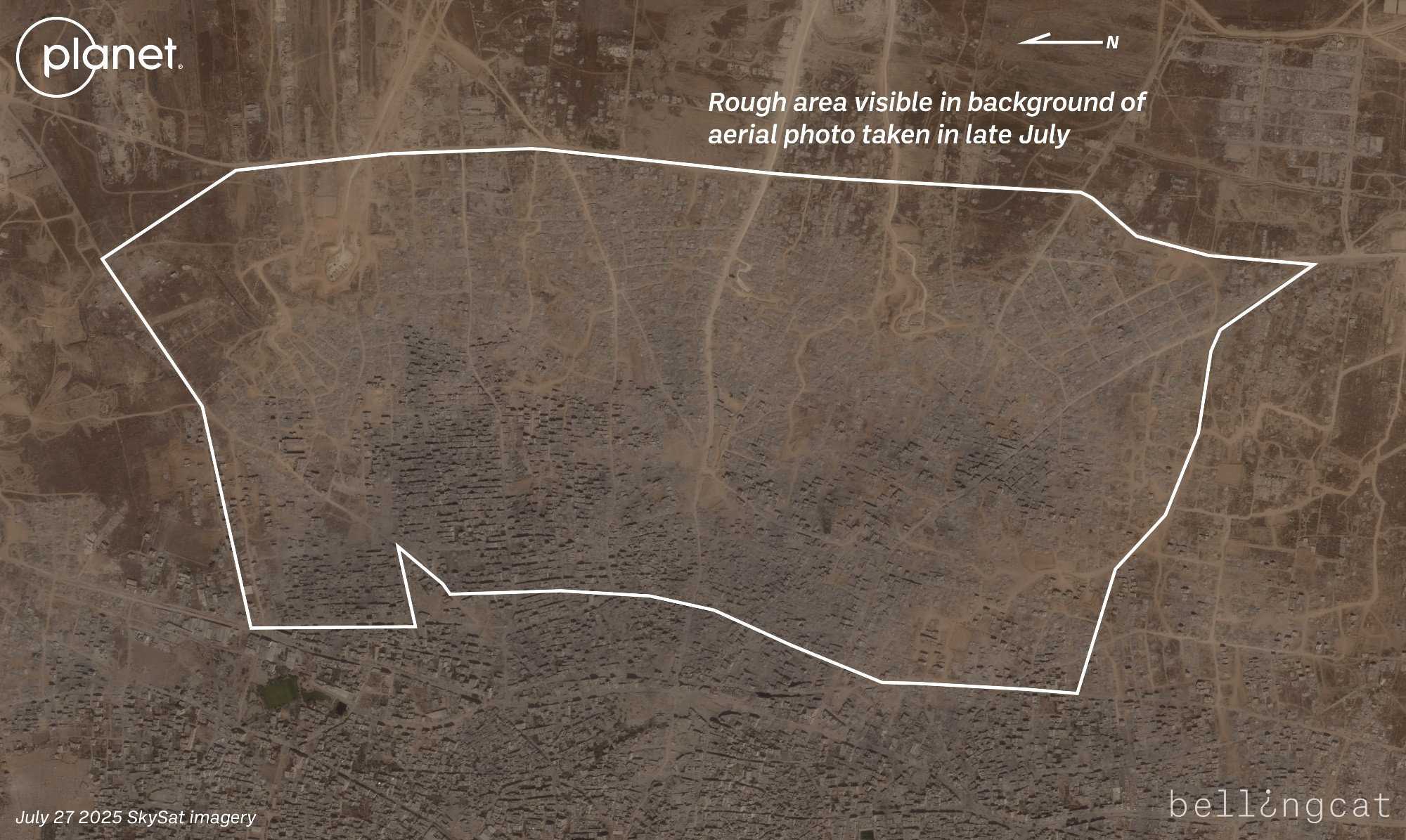
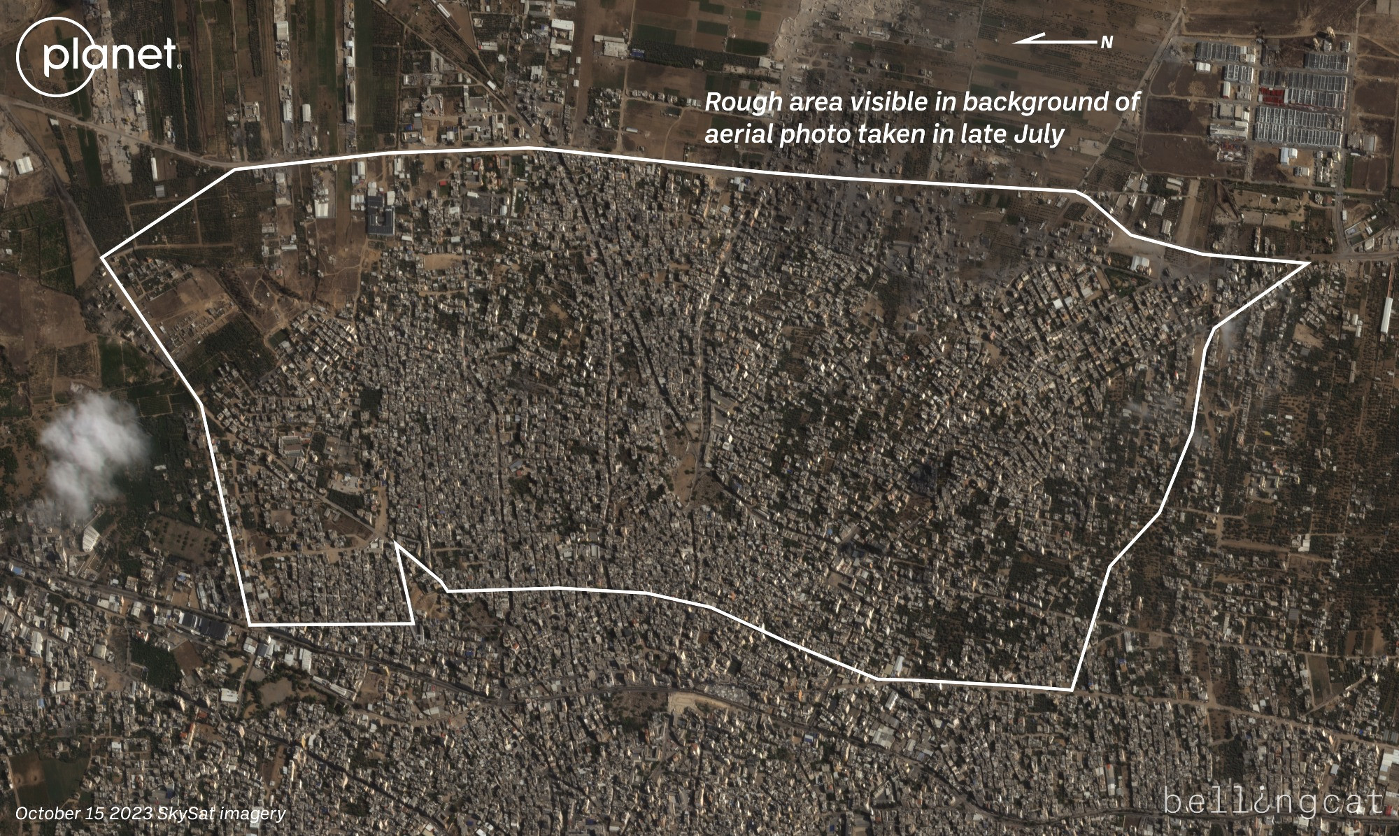
Can just barely see it but the massive destruction in Gaza City's eastern neighborhoods such as Shejaiya and Tuffah is visible in the background of the photo. When compared with a satellite image taken a week after the war started, can see thousands of homes have been razed.
For another comparison, there's also an aerial view from a similar perspective, though at lower altitude since it's from a drone photographer, here on Facebook from 2019: www.facebook.com/photo/?fbid=...
The drone photo is closer to 31.5057, 34.4619 whereas the plane photo is closer to the coast.
📌