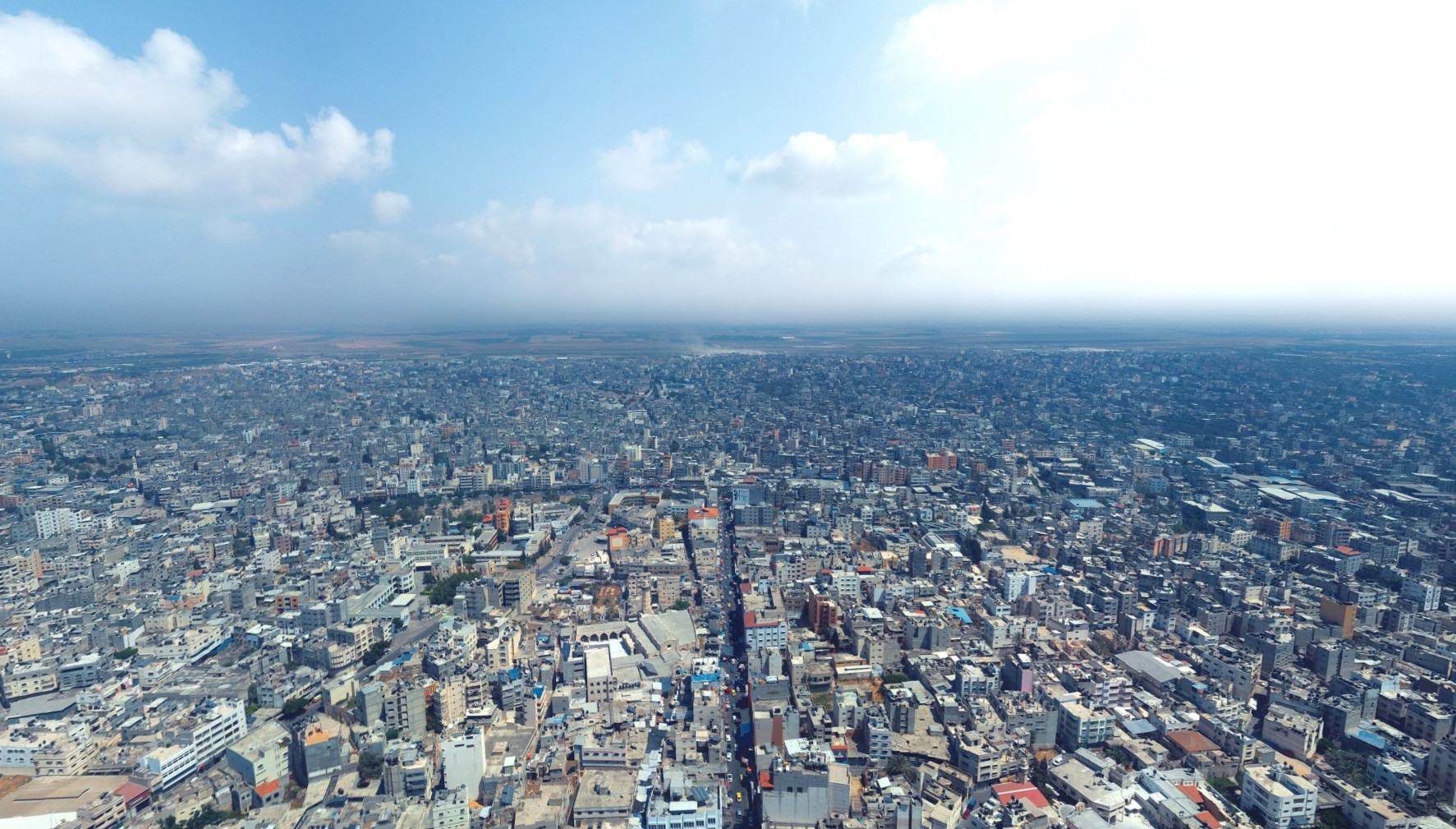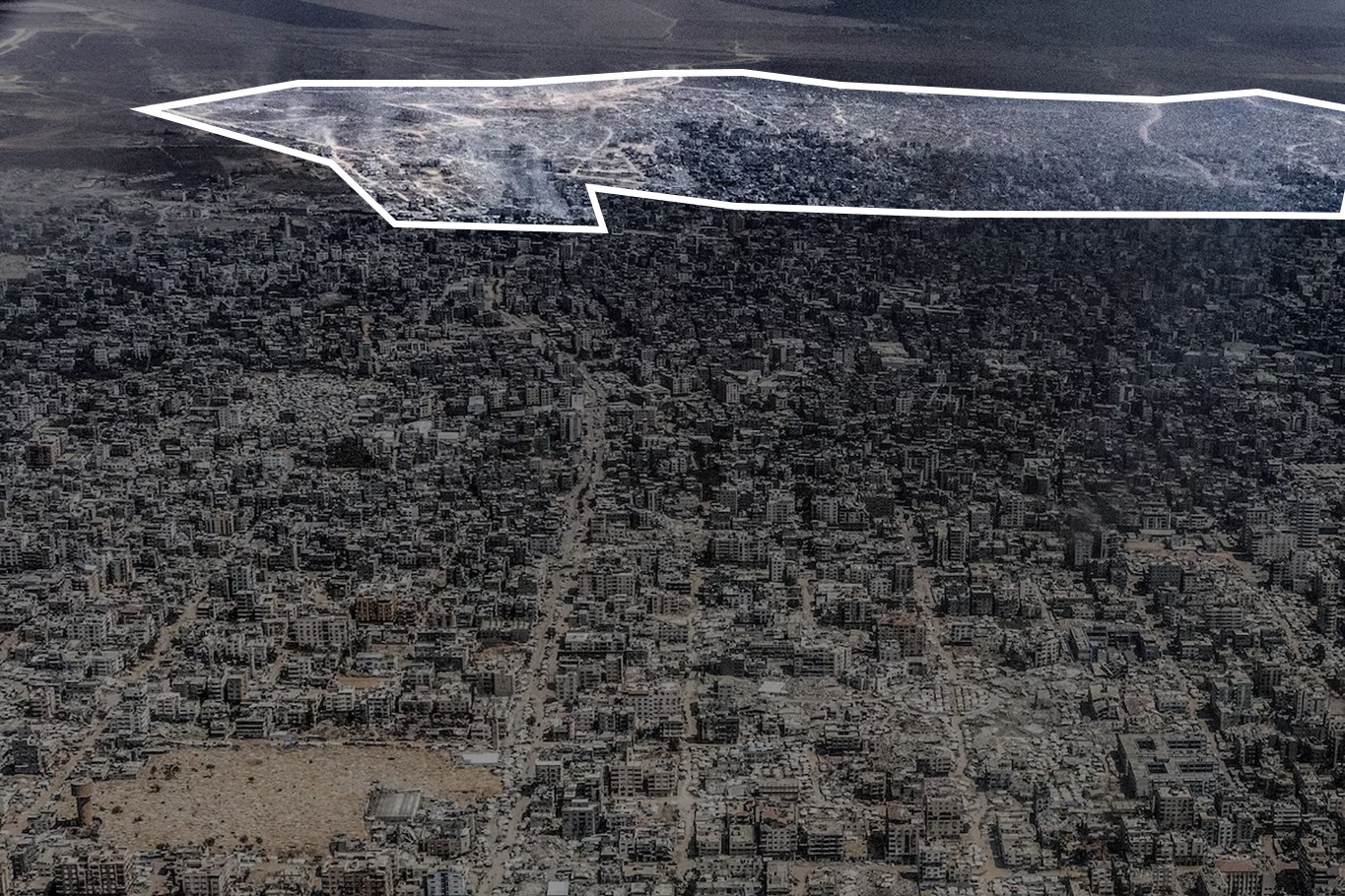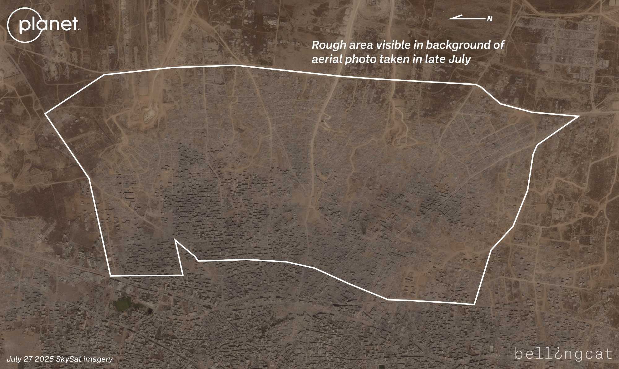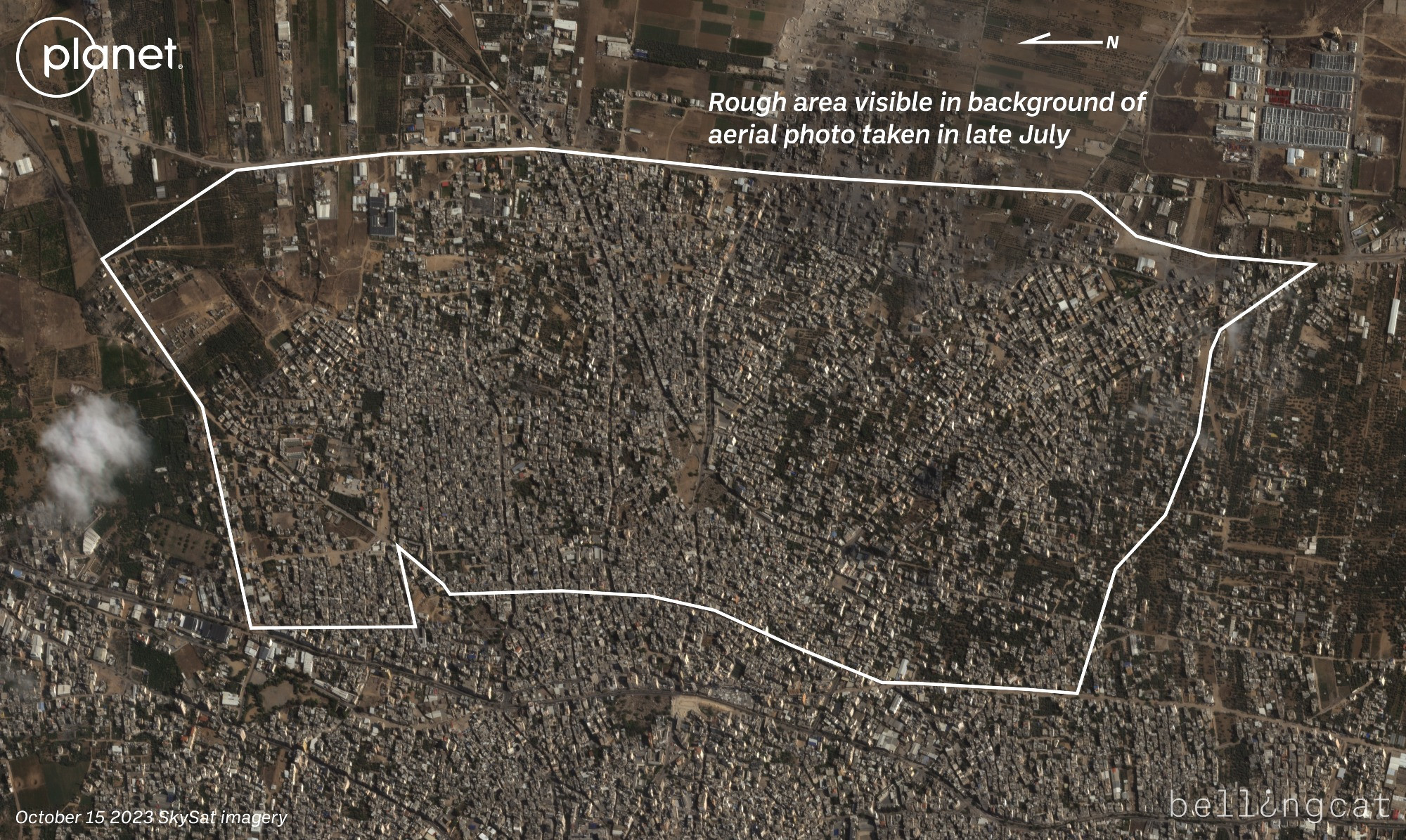
For another comparison, there's also an aerial view from a similar perspective, though at lower altitude since it's from a drone photographer, here on Facebook from 2019: www.facebook.com/photo/?fbid=...
The drone photo is closer to 31.5057, 34.4619 whereas the plane photo is closer to the coast.